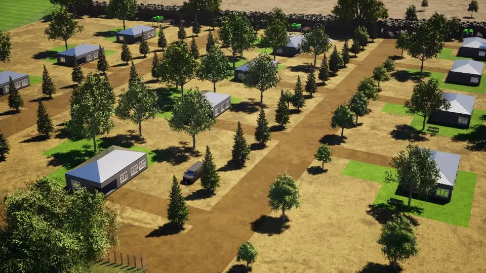
Our 3D Farm Mapping and Modeling service transforms your land into an interactive, digital model—giving you a powerful tool for planning, design, and decision-making. Using drone surveys, satellite imagery, and advanced GIS tools, we create accurate 3D visualizations of your farm’s landscape, including elevation, land use, water flow, and infrastructure layout.